

Orienteering/Land Navigation is a valuable skill for us. Being able to determine exactly where we are on a map is critical. Also, it is a perishable skill and requires practice and repeated use to maintain proficiency.
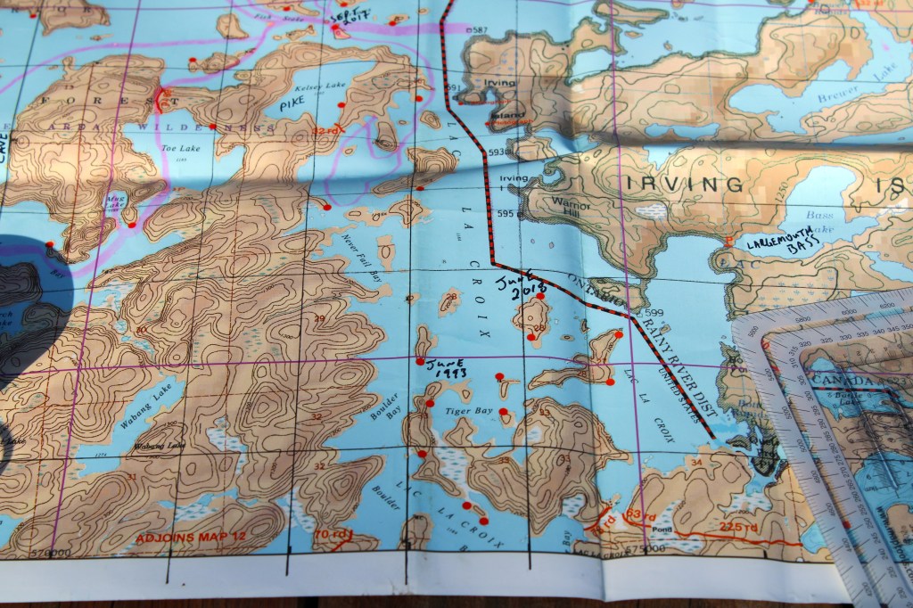
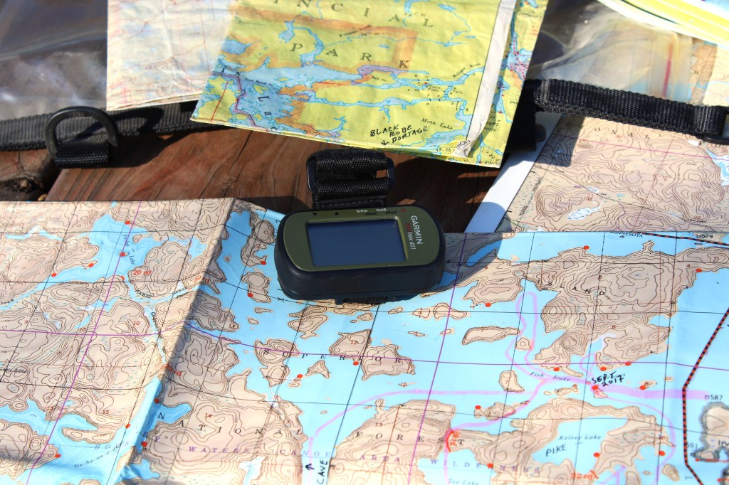
For trip planning, we rely on topographical maps, Google Earth satellite images, county maps and even real estate maps sometimes. When traveling in our vehicle we rely on GaiaGPS because of its offline capabilities. We have the paid upgraded subscription for the added benefits we need. It takes some time to learn any new navigation system and this was no different. I use a Lenovo M10 FHD Plus since it has built-in GPS. That’s the main point when using a tablet for navigation: BUILT-IN GPS. My new Chuwi Hi 10X doesn’t have it.
My current land navigation system of choice is a map, a compass and a GPS utilizing the UTM format and a slot tool. UTM stands for Universal Transverse Mercator which basically means the Earth has been sectioned into grids of roughly 1000 meters square.
The GPS gives me coordinates in a UTM format. I take those coordinates and apply them to the map with a UTM Slot Tool. It sounds complicated but it is not. Once you understand the concept of using UTM it becomes really fast and accurate.

There is a company that I purchase my slot tools from called MapTools and their website is http://www.maptools.com
There are several options when it comes to slot tools and they also depend on your brand of map and map-scale. The prices are reasonable and I usually buy several.
I do not 100% rely on a GPS since batteries can fail or electronics can fizzle out, so having basic Orienteering skills is a must. Rather, I try to use all of the tools available at my disposal to get the job done.
This method comes in handy when locating backcountry camp sites, marking fishing hotspots, points of interest and even general location as well as time management. We always carry Gazeteers or topographical maps of the areas we are camping/fishing in.
My compass of choice for taking a bearing is the USGI Cammenga. Pricey, but rugged and the easiest I have found to shoot an azimuth. Baseplate compasses such as Suunto or Silva are great too for using in conjunction with a map. I carry a Suunto as a backup.
MapTools has a kit for beginners who want to use the UTM system and a slot tool. It is very thorough and helpful in explaining and putting to use the concept of UTM.
This might sound like overkill for fishing but something to consider is that backcountry forest roads are notorious for always changing or not showing up on maps. Logging roads are even worse. When getting turned around or temporarily confused, it’s a simple matter of reading the GPS coordinates, pulling out a map and a slot tool, and fixing your current position. You can make informed decisions from there and decide what to do next.
There are many benefits to the UTM system and it might be worth exploring. Thanks for reading and I hope this post was useful.
NOTE: UTM or Universal Transverse Mercator is made up of 3 components.
-A Zone Identifier
-East/West location
-North/South location
